
Picture an hourglass lying on its side, the top resting in the Mississippi River to capture the sands of time floating downstream from the Midwest. The sand flows through the neck of the hourglass and empties into Barataria Basin, where scientists predict it will create and nourish freshwater marshes and saltwater wetlands to stave off an expected dramatic loss of Louisiana’s coast over the next 50 years.
That’s the concept behind the Mid-Barataria Sediment Diversion project, a $2 billion proposal to rebuild a basin that has been eroding for more than a century because of natural subsidence, erosion by hurricanes and storms, construction of hundreds of miles of oil and gas canals and navigation channels and, more recently, increasing rates of human-accelerated sea level rise.
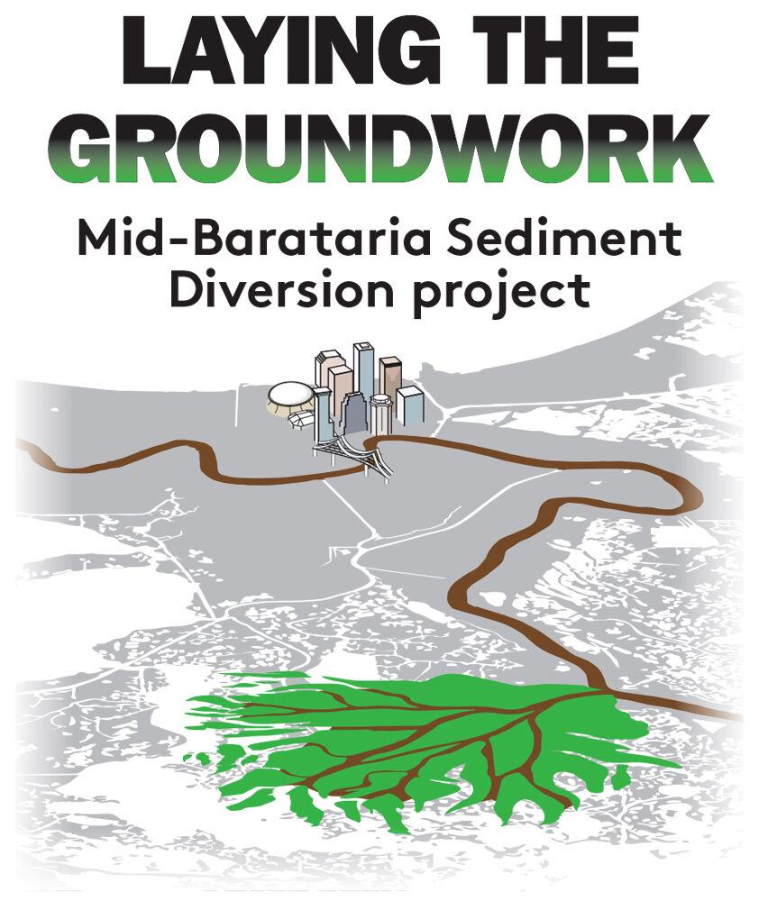
One in a series of stories on the $2 billion project to restore basin wetlands in Louisiana
It’s enormously expensive, one of the costliest projects in Louisiana’s coastal Master Plan, the state’s 50-year, $50 billion bid to keep the Gulf of Mexico from swallowing 20 parishes and to protect them from hurricane storm surge. It’s controversial, and it’s risky, too, for while scientists are confident in their work and their predictions, hardly anything has ever been attempted on this scale.
“The intent of the project is to change things. We know the trajectory the Barataria Basin is on right now and it’s not a good one,” said Bren Haase, executive director of the Coastal Protection and Restoration Authority.
“Literally, there are tons of sediment passing through our river every day, every week and every year,” he said. “So the idea behind this project is to tap that resource, tap that sediment being moved by the Mississippi River, and introduce it into the Barataria Basin to help restore some of those wetlands that are in the basin and all those functions that are so important associated with those wetlands.”
Conservationists, business people, residents and politicians have been wringing their hands for decades over Louisiana’s fragile coast. One pr…
The Army Corps of Engineers released its draft environmental impact statement on the project in March, and the public comment period on that assessment closes Thursday. Next, the Corps will revise the report, produce a final statement probably next spring and ultimately decide, perhaps in 2023, whether to permit Louisiana to move ahead with construction.
Here’s why the project is proposed, how it was designed and how it might work.
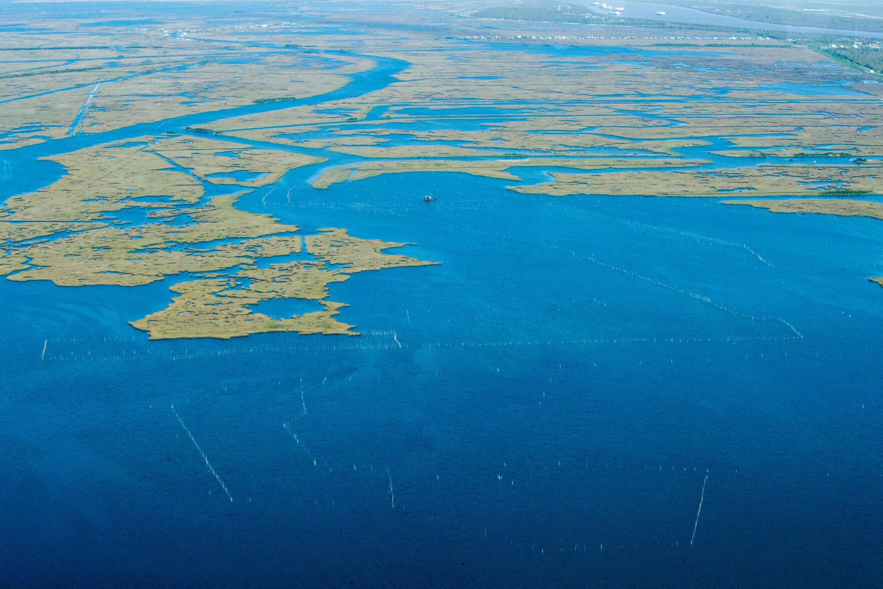
Land lost
In 2020, the Barataria Basin contained only 509 square miles of wetlands, marsh and land, according to the Army Corps of Engineers. While that’s an area almost as large as Phoenix, Arizona, consider that in 1935 the basin contained more than 935 square miles of wetlands, almost the size of the state of Rhode Island.
The Corps says the diversion will create 27 square miles of new marsh and wetlands by 2050. Additional sea level rise is likely to reduce that to 21 square miles through 2070.

Modeling conducted for the state indicates the Mid-Barataria Sediment Diversion will build more new wetlands than if no project is built. These five maps show the difference in land gained (blue) and lost (red), compared to no action, at the end of each of the first five decades of of the diversion’s operation.
But without the diversion, the basin’s wetlands will shrink to only about 81½ square miles, or 16% of its 2020 size, according to computer modeling conducted for the environmental assessment. Even with the diversion, only about 133⅔ square miles will remain in the basin by 2070.
The diversion is being designed to mimic the Mississippi’s historic land-building process, which, before the river was leveed, created most of southern Louisiana over the past 7,000 years, including the land on which the New Orleans metropolitan area sits. Restoring some of the historic coast in the 21st century will help protect populated areas from tropical storms and hurricanes.
But instead of letting the river roam free again to build a new delta, with all of the water it carries to Louisiana from 32 states and two Canadian provinces, the diversion would capture only about 7.5% of the river’s flow. That amount would be directed through the 2-mile-long diversion channel into the eastern, mid-level Barataria Basin.

Artist rendering of the Mid-Barataria Diversion Structure
Scientists and engineers designing the diversion have had to determine what they think is the best location along the river and the rules for opening and closing the diversion, and to make a variety of decisions on how much sediment, nutrients and other environmental contaminants will be released into the basin when it begins operating.
The amount and kinds of sediment captured by the diversion, and the time of year that it would be captured, were among the first, and most important, questions facing its design.
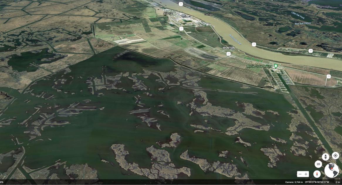
The project would be built at river mile marker 60.7, just downriver from the Phillips 66 Alliance oil refinery and the proposed Plaquemines Liquids Terminal and just upriver of the Ironton and Myrtle Grove communities.

Map of the Mid-Barataria sediment diversion project.
“We actually sited the diversion based on the ability of that site to capture sediment loads, specifically sand loads,” said Wes LeBlanc, a coastal resources scientist at the Coastal Protection and Restoration Authority and manager for the project.
The largest grains would be captured as the river begins to rise as a result of winter and spring floodwaters moving down from the Midwest. Researchers determined that those large grains, mostly sand, would likely drop out of the water near the diversion’s outlet, while smaller sand grains, organic material and mud particles would be carried farther south and west in the basin by the freshwater. Some of it would eventually settle out on or near existing wetlands, helping to assure their survival.
The diversion’s location was chosen in part because the Mississippi’s water would pass over one or more sand bars between the river’s navigation channel and the West Bank levee, capturing a greater share of bar sand just before entering the diversion structure.

This bar chart shows the flow of water and sediment through the diversion during each month of the year. The diversion will have a base flow of 5,000 cubic feet per second when its gates aren’t open. The gates will open, and the diversion will carry between 25,000 and 75,000 cubic feet per second as the river’s flow reaches 450,000 cubic feet per second and increases to 1 million cubic feet per second or greater.
The researchers also had to determine the best time of year to open and close the diversion, based on records of the amount of sediment in river water during a 50-year period from 1964 through 2013.
“At low flow, there’s no sand in suspension in the river,” said Ioannis Georgiou, director of coastal and deltaic systems modeling at The Water Institute of the Gulf and formerly director of the University of New Orleans’ Pontchartrain Institute for Environmental Sciences. “The sand gets trained [in the water] as the flow transitions from low to high.”
The trigger delivering the most large sand grains is when the river’s flow reaches 450,000 cubic feet per second upstream at Belle Chasse. At that point, the diversion gates are opened and 25,000 cfs of water and sediment will flow into Barataria Basin. As the river speeds to 1 million cfs, the amount diverted will increase to a maximum of 75,000 cfs.

This rendering shows the inflow area of the proposed diversion, including a wide apron designed to channel water and sediment towards gates, and the floodwalls and structures aimed at keeping the diversion safe from river traffic.
At its highest flow, the diversion will deliver an average 50,000 metric tons of sand and soil per day into the basin. But it’s more likely that the average flow when the gates are open will be about 33,636 metric tons per day. That’s enough sediment to fill the Louisiana Superdome in 92 days, or fill 198 Superdomes over 50 years.
However, the larger grain sizes best suited for land building, between 63 and 250 microns, represent only about 26 percent of the sediment load. That translates into filling the equivalent of 52 Superdomes over 50 years.
The lighter sediment, a combination of sand, organic material and mud particles, isn’t lost, though, Georgiou said. As it moves farther out in the basin, many of these particles will be caught by marsh and wetland grasses, or deposited on the grasses during high tides or storms, with the remainder slowly settling into open water.

This graphic shows the apron that will be used at the exit of the diversion to allow water to transition into the Barataria Basin without causing erosion.
The 50-year sediment load modeling was combined with detailed bathymetry, the mapping of water depths, of the present mix of wetlands and open water. That let scientists estimate the amount and location of new land built over 50 years, said Jim Pahl, a senior coastal resources scientist with the coastal authority. Included in the estimates are assumptions of the rate of sea level rise and land subsidence, and other natural conditions that might affect the way land builds, he said.
The state predicts the Gulf of Mexico will rise almost 5 feet in Barataria Basin by 2100. That’s based on expected increases in the worldwide release of greenhouse gases such as carbon dioxide through the remainder of this century.
Subsidence rates, the natural sinking of land, near the diversion site is averaging about 5 millimeters a year, the equivalent of another 10 inches of sinking through 50 years. Thus the combined effect of rising seas and sinking land is that the water in the basin could be 5 feet, 10 inches deeper by 2100.

This map shows where water from the diversion will flow, and how fast, in the Barataria Basin between 2050 and 2059 when the diversion is operating at its maximum, carrying 75,000 cubic feet per second from the river into the basin.
If worldwide greenhouse gas reduction efforts are successful in coming decades, like Gov. John Bel Edwards’ proposed reduction in Louisiana’s releases to 2005 levels by 2050, sea level rise rates might be less, resulting in more new land created by the diversion.
“What we’re providing are not absolute predictions that in year 5, it’s going to be this, year 10 is going to be this,” Pahl said. “It gives us an order of magnitude of estimation of what we believe is going to be the outcome.”
The modeling included some runs with the proposed Mid-Breton Sediment Diversion in operation on the river’s east side and a bit upstream. It also included some runs that assumed the state would indeed build separate marsh creation projects it is planning within the basin.
Land loss in parts of Louisiana is occurring at a rate equivalent to one football field every 100 minutes. How is that happening?
The modeling also looked at the effects of nutrients carried by river water into the basin. The nutrients include fertilizer that is used on farms throughout the river’s huge watershed and flows downstream during spring and summer months. Some nutrients come from untreated or inadequately treated sewage.
They are important to the diversion’s success because they will spur plant growth in both existing wetlands and the new land platforms created by the diversion’s sediment. As the fertilized plants die and decompose, their organic matter will be added to the new sediment, increasing the height of the new platforms.
The suite of models used to design the diversion predicts where nutrients, including nitrogen and phosphorus, will be transported, and how much will be taken up by plants or will simply decay in water.
The destination of the nutrients also is important because phosphorus and nitrogen that the river now carries to the Gulf of Mexico causes the annual summertime low-oxygen dead zone along the state’s coastline. The nutrients spur blooms of algae that eventually dies and sinks into the the ocean’s floor, decomposing and using up oxygen in the water column, creating a condition of very low oxygen called hypoxia. Organisms that live on the bottom are killed by the lack of oxygen, while shrimp and fish tend to swim away to deeper waters with more oxygen.

The federal-state Mississippi River/Gulf of Mexico Hypoxia Task Force has been trying to get states along the river to reduce their use of fertilizer, and the amount ending up in the river, since 1998. Voluntary reduction efforts have been largely unsuccessful.
Pahl said the modeling of nutrients diverted from the river to the basin assumes that the amount of nutrients carried by the river doesn’t change from levels measured during the past 50 years.
In the basin, nutrients might still impair oxygen in the water, but not to levels violating state Department of Environmental Quality standards, the Corps’ environmental statement concludes.
Another area of uncertainty is the potential for block faulting: Whether the weight of sediment in newly built wetlands could cause the geologic blocks of the underlying earth to sink rapidly. Pahl said the environmental statement acknowledges there’s a chance that would happen, but assumes it will not.
“Just because there’s a fault somewhere, what is our level of certainty that we can say that if we have a diversion layering new sediment on top of that marsh where the fault is, is that going to induce a slump in an isolated geologic block?” he said. “I don’t think anybody can say with certainty that is going to happen or not.
“We’ll be monitoring that as best we can and hoping that at some point the state of the science catches up to provide something more appropriate to use as an advisory,” he said.
Public comment period on $2 billion coastal restoration project ends June 3
Mid-Barataria project seen to create 27 square miles of land, displace brown shrimp and oysters
Near the coast, there’s not enough sediment to rebuild marshes; upriver, they can’t get rid of it
$2 billion plan to restore 21 square miles of coast would destroy economy, culture, opponents say
Coastal restoration initiative threatens fishing, dolphins, economies, cultures, foes say
Chugging through Bay Denesse, Ryan Lambert’s boat struggles forward, kicking up the silt and clay sitting just a few feet below the water’s su…

Bottlenose dolphins would become “functionally extinct” in two of four areas of Barataria Bay, and the number of dolphins will drop dramatical…
CORRECTION: An earlier version of this story incorrectly described the Mid-Barataria Sediment Diversion as the second most expensive project in Louisiana’s 2017 coastal Master Plan. That plan listed its cost as $998.8 million, which ranked it 13th at the time but is half its present estimated cost of $2 billion.


More Stories
Real Estate Agents – What to Look for in a Mentor
Typical Workday of a Real Estate Agent
What You Can Expect To Pay A Playa Del Carmen Realtor